
Storm Command Center
South Louisiana flood awareness, storm briefing, radar, river gauges, rainfall graphics, hurricane outlooks, live satellite links, traffic cameras, emergency alerts, power outages, marine weather, and coffee truck event planning.
Command Briefing
Fast decision dashboard for South Louisiana weather, flooding, roads, outages, and outdoor event planning.
Start with radar, NWS alerts, rainfall forecast, and river gauges. Live score updates if forecast data is available.
During heavy rain, check WPC rainfall outlooks and Amite River gauges at Port Vincent and French Settlement.
Before outdoor setup, check heat, rain, lightning, wind, roads, and outages.
Storm Briefing
Use this order when weather starts getting serious in South Louisiana.
Storm Mode Checklist
Use this order when weather starts getting serious.
Critical River Gauges
Open these first during heavy rain or river flooding concerns.
One-Click Situation Check
Fast outside resources for a complete weather picture.
Billy’s Favorites
The fastest links to check first when people start asking, “Are we good?”
Most Important Flood Gauges
Quick checks for French Settlement, Port Vincent, Baton Rouge, and Pass Manchac.
Storm Checks
Radar, satellite, hurricane center, and rainfall forecast.
Local Safety
Roads, Livingston Parish alerts, outages, and state emergency resources.
Live Radar Center
Radar is the first thing to check when storms are already developing. Use multiple radar sources if one is slow or down.
Local NWS Radar
Official radar near Hammond / southeast Louisiana. Best starting point for storms near Livingston Parish.
Google Weather Radar
Easy mobile-friendly radar search for French Settlement and surrounding areas.
RainViewer Radar
Simple animated radar map that is often easy for the public to understand.
Windy Weather Map
Great for wind, rain, pressure, tropical moisture, and Gulf weather movement.
Tropical Tidbits
Popular weather model resource for tropical systems, rainfall patterns, and Gulf storm setup.
Severe Weather Outlook
Check tornado, hail, damaging wind, and severe storm outlooks.
Local Weather Forecasts
Quick forecast links plus live cards if browser forecast data loads correctly.
French Settlement
Baton Rouge
New Orleans
Coffee Truck Weather
Outdoor setup planning for Espresso Geaux, markets, schools, churches, events, and pop-ups.
Espresso Geaux Event Suitability
Quick outdoor setup helper. Live status updates if forecast data loads.
Before setting up, check radar, lightning, wind, heat index, road closures, and outages. Secure tents, signs, umbrellas, table items, and generators.
Outdoor Event Checks
Useful for coffee truck setups, markets, school events, and church events.
Go / Caution / No-Go Guide
A simple outdoor event rule of thumb.
Light wind, no lightning nearby, roads clear, manageable heat.
Scattered storms, heat advisory, gusty wind, or wet road setup.
Lightning nearby, severe thunderstorm warning, flooded roads, high wind, or unsafe setup conditions.
Gulf Hurricane Tracker
Official tropical outlooks plus trusted outside tropical weather resources.
Atlantic / Gulf 2-Day Tropical Outlook
Short-range tropical development outlook from the National Hurricane Center.

Atlantic / Gulf 7-Day Tropical Outlook
Extended tropical development outlook from the National Hurricane Center.

National Hurricane Center
Official tropical weather, cones, advisories, discussions, storm surge, and marine products.
Tropical Models
Helpful for watching possible tropical setup, model trends, and Gulf storm tracks.
Mike’s Weather Page
Popular tropical weather dashboard with many hurricane and Gulf weather links in one place.
Live Satellite View
Satellite helps you see storm organization, Gulf moisture, cloud tops, and tropical movement.
Zoom Earth Live Satellite
Useful for tracking cloud cover, fronts, storm movement, tropical systems, and Gulf weather.
NOAA GOES Satellite
Official NOAA satellite imagery for the Gulf, Caribbean, and Atlantic.
NHC Satellite Page
Official hurricane satellite products and tropical weather imagery.
Rainfall Graphics & Flooding Risk
For South Louisiana flooding, rainfall forecast often matters before river gauges start rising.
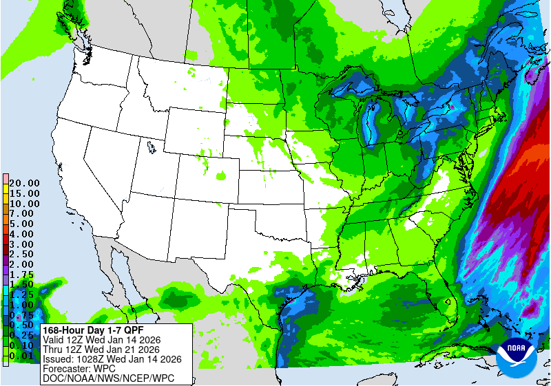
7-Day Rainfall Forecast
NOAA Weather Prediction Center 7-day precipitation forecast.
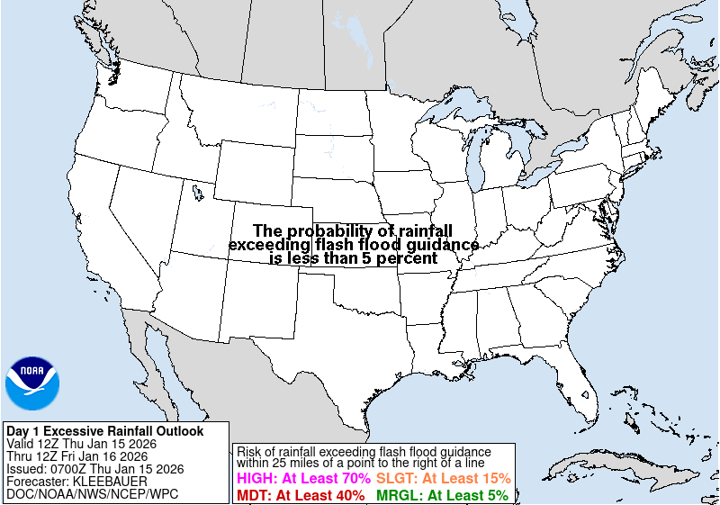
Excessive Rainfall Outlook
Flash flooding risk outlook from NOAA/WPC.
Flash Flood Guidance
Helpful for understanding how quickly rainfall may create flooding problems.
Storm Surge & Coastal Flooding
Helpful during tropical systems, strong southerly winds, and high water around Lake Pontchartrain and Maurepas.
National & Local Alerts
Current watches, warnings, and advisories.
River Crest & Forecast Resources
Use these when rain has already fallen upstream or when rivers are forecast to rise.
Amite River Forecasts
Port Vincent and French Settlement forecast hydrographs.
Lake / Coastal Gauges
Pass Manchac and Maurepas-area coastal monitoring.
Mississippi River Forecasts
Donaldsonville, Baton Rouge, Red River Landing, and Cairo.
NOAA River Forecast Map
National map of river observations and forecasts.
Lower Mississippi Forecast Center
Official river forecast center for the Lower Mississippi region.
Flood Warnings
Current local watches, warnings, and advisories.
Marine, Lake & Coastal Conditions
Helpful for Lake Pontchartrain, Lake Maurepas, Pass Manchac, Blind River, coastal flooding, tropical systems, and strong south winds.
Lake Pontchartrain Marine Forecast
Wind, waves, marine advisories, and lake conditions.
Coastal Waters Forecast
Useful for tropical systems, wind direction, seas, and coastal flood setup.
Water Levels
NOAA water levels and tide tools for coastal flooding and lake level checks.
Wind Forecast
Helpful for tents, trailers, boat launches, outdoor markets, and lake conditions.
Storm Surge
Important during tropical systems and strong onshore flow.
Boat Launch Weather
Useful for Pass Manchac, Blind River, Lake Maurepas, Lake Pontchartrain, and nearby waterways.
Tides, Lightning & Event Safety
These are useful for outdoor events, lake conditions, truck setups, school events, church events, and markets.
Tides & Water Levels
Useful for Lake Pontchartrain, Pass Manchac, Maurepas, and coastal flooding checks.
Lightning Safety
Important for outdoor events, schools, churches, farmers markets, and the coffee truck.
Heat Safety
Helpful during summer truck events and long outdoor service days.
Road Closures, Emergency Alerts & Traffic Cameras
Road closures, camera shortcuts, parish alerts, power outages, and local emergency resources.
511LA Traffic Map
Live traffic map with incidents, construction, road closures, weather-related conditions, travel times, and cameras.
Traffic Camera Shortcuts
Quick search links for 511LA traffic cameras. These open the official 511LA camera viewer with the search term already added.
DOTD Road Closures
Louisiana DOTD traveler information for closures, road work, restrictions, weather road conditions, and travel updates.
Livingston Parish Alerts
Official Livingston Parish emergency information, LOHSEP resources, and Alert Center / Notify Me alerts.
Louisiana Emergency Alerts
State emergency resources, alert systems, shelter information, and preparedness resources.
Local Emergency Alerts
Quick links for Baton Rouge, West Baton Rouge, Ascension Parish, and state emergency resources.
Power Outages
Check electric outage information and restoration updates.
Internet & Phone Outages
Useful during storms when card processing, phones, cameras, and business systems are affected.
Severe Weather Outlooks
NOAA Storm Prediction Center convective outlooks for severe weather risk.
Flood Map & River Gauges
NOAA embeds can be slow or blocked on some phones. Each gauge includes a direct “Open Gauge” button so the page still works even if the embed does not load.
1. NOAA National Water Prediction Service
Main water and flood map
2. Amite River at Port Vincent
Gauge ID: PVLL1
3. Amite River at French Settlement
Gauge ID: FSLL1
4. Coastal Reference Monitoring System near Maurepas
Gauge ID: DNAL1
5. Lake Pontchartrain at Pass Manchac near HWY 51
Gauge ID: MCHL1
6. Mississippi River at Donaldsonville
Gauge ID: DONL1
7. Mississippi River at Baton Rouge
Gauge ID: BTRL1
8. Mississippi River at Red River Landing
Gauge ID: RRLL1
9. Ohio River at Cairo
Gauge ID: CIRI2